Showing posts with label Surveyors. Show all posts

Tuesday, June 2, 2020

Somewhat Safer After Point Pleasant


Monument At Point Pleasant, West Virginia

From the FLOWERING of the CUMBERLAND by Harriette Simpson Arnow:


"The land that was to be Kentucky and Tennessee grew somewhat safer after the Point Pleasant Campaign of 1774 that marked the end of Dunmore’s War and the defeat of the Shawnee. Harrodsburg, Kentucky, was founded in that year. Also came the surveyors, locating boundaries for the land warrants Virginia had used to pay her soldiers in the French and Indian War. Some of these, including several hundred acres for George Rogers Clark, were located on the Middle Cumberland in the neighborhood of French Lick, for at this time most thought all the Cumberland was due west of Virginia instead of North Carolina."


Cabin Near Shelbyville, Kentucky


Tuesday, March 3, 2020

Surveying Expedition Of Washington And Fairfax


Source


"One spring morning, early in the month of March, 1747, eight years before the French and Indian war,  two young men might have been seen standing at the gates of 'Old Belvoir' the elegant home of the Hon. Wm. Fairfax on the Virginia shore of the Potomac river, two miles below Mount Vernon...".


Friday, January 24, 2020

Andrew Ellicott's Inventiveness


Source

The problems he [Andrew Ellicott] was required to solve were many and difficult, and the record he has left behind him is one of hard work well and often brilliantly done. ...his father, Joseph Ellicott, was remarkable in his day for a variety of mechanical and scientific attainments, and that the whole Ellicott family as far back as 1600 had shown in each generation a marked inventiveness and a knowledge of mathematics above the ordinary.

Andrew Ellicott was born January 24, 1754, in Bucks County, Pennsylvania, and it is probable that he secured the rudiments of his education at the little Quaker school in the township of Solesbury.


Friday, December 20, 2019

One Of Washington's Surveying Tools


Displayed at Karl C. Harrison Museum Of George Washington In Columbiana, Alabama


"Washington...kept a diary not only of all surveys of the tracts and lots made, but also of many curious and interesting circumstances incident to the wild, romantic life which their business required." [Source]

Cross-posted at In Deeds


Saturday, July 6, 2019

Pike Was Chosen To Trace The Mississippi


The Expeditions of Zebulon Montgomery Pike, Volume 1 (of 3) by Pike

I was chosen to trace the Mississippi to its source, with the objects in view contemplated by my instructions; to which I conceived my duty as a soldier should induce me to add an investigation into the views of the British traders in that quarter as to trade, and an inquiry into the limits of the  territories of the United States and Great Britain.

In the execution of this voyage I had no gentleman to aid me, and I literally performed the duties (as far as my limited abilities permitted) of astronomer, surveyor, commanding officer, clerk, spy, guide, and hunter; frequently preceding the party for miles in order to reconnoiter, and returning in the evening, hungry and fatigued, to sit down in the open air, by firelight, to copy the notes and plot the
courses of the day.


Saturday, June 22, 2019

General Rufus Putnam's Work In The South


Florida Panhandle

From the Journal of Gen. Rufus Putnam, a brief history of his work after the French-Indian War:


Thursday, May 25, 2017

George's Insight


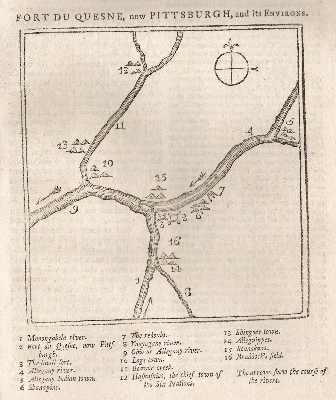
Source - 1759 Map Of Pittsburgh Area (Probably Not Washington's Map)

From The Plains of Abraham by Brian Connell:

George, precise and methodical, had his surveyor's notebook with him, making a remarkably accurate map of their progress, pin-pointing likely land for clearance and development and applying his as yet untrained military mind to the possibilities of erecting forts and strong points. With true insight, he made a special note of the gently rising point of land where the Monongahela and the Allegheny join, now the site of the city of Pittsburgh.


Saturday, September 6, 2014

At The Confluence


At The Confluence Of The Ohio And Kanawha Rivers

History of the Battle of Point Pleasant ... :

Scarcely had the storms of winter subsided when there was an army of surveyors and land-jobbers on the Ohio. In January of this year, William Preston, Surveyor-general, of Fincastle county, which then included all the territory south of the Ohio below the mouth of the Great Kanawha, gave notice to officers and soldiers who claimed land under his Majesty's proclamation of the 7th of October 1763, and who had obtained warrants for the same from the Earl of Dunmore, to meet his deputy surveyors at the mouth of the Great Kanawha river, on the ensuing 14th of April, that their lands might be located.